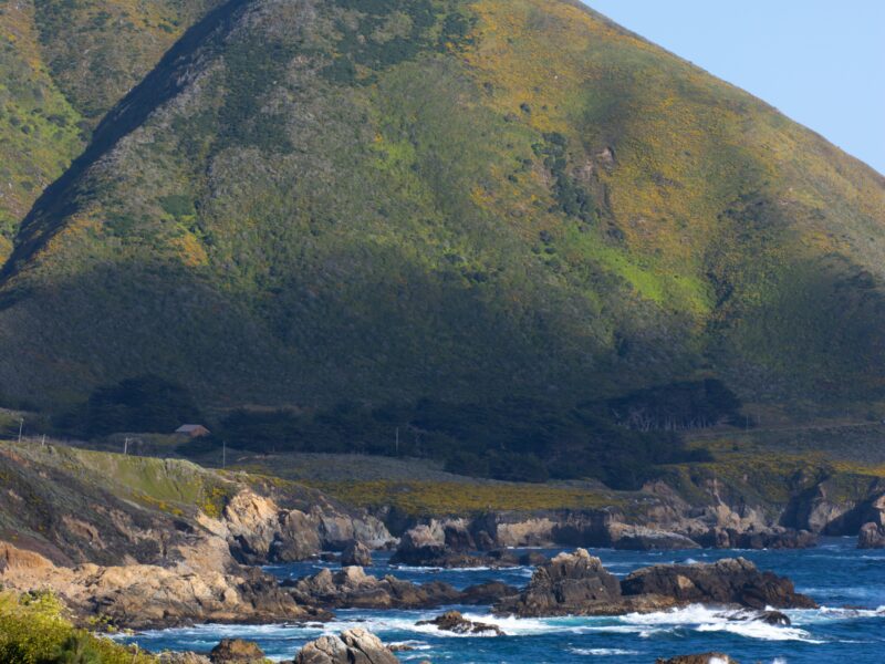
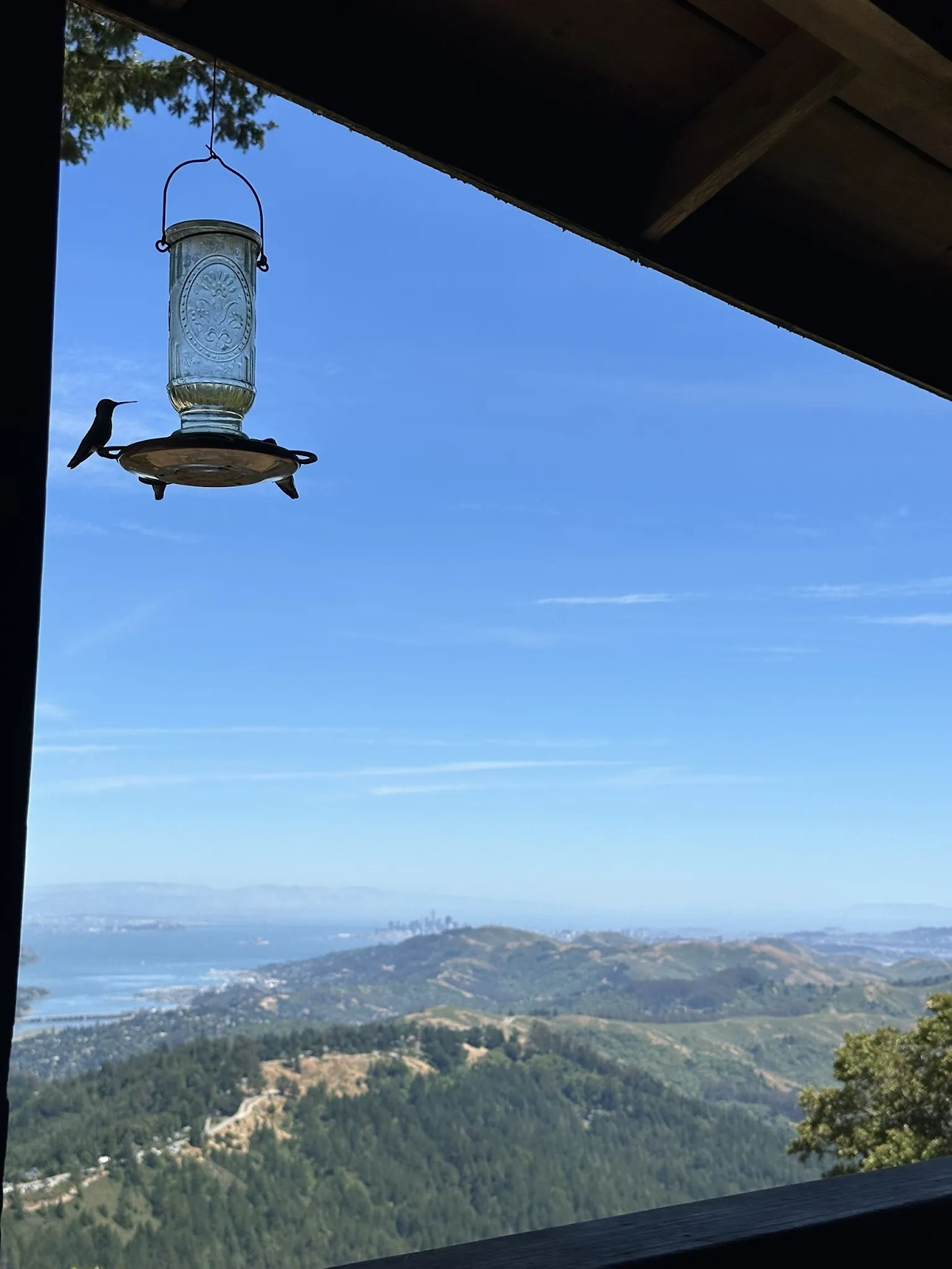
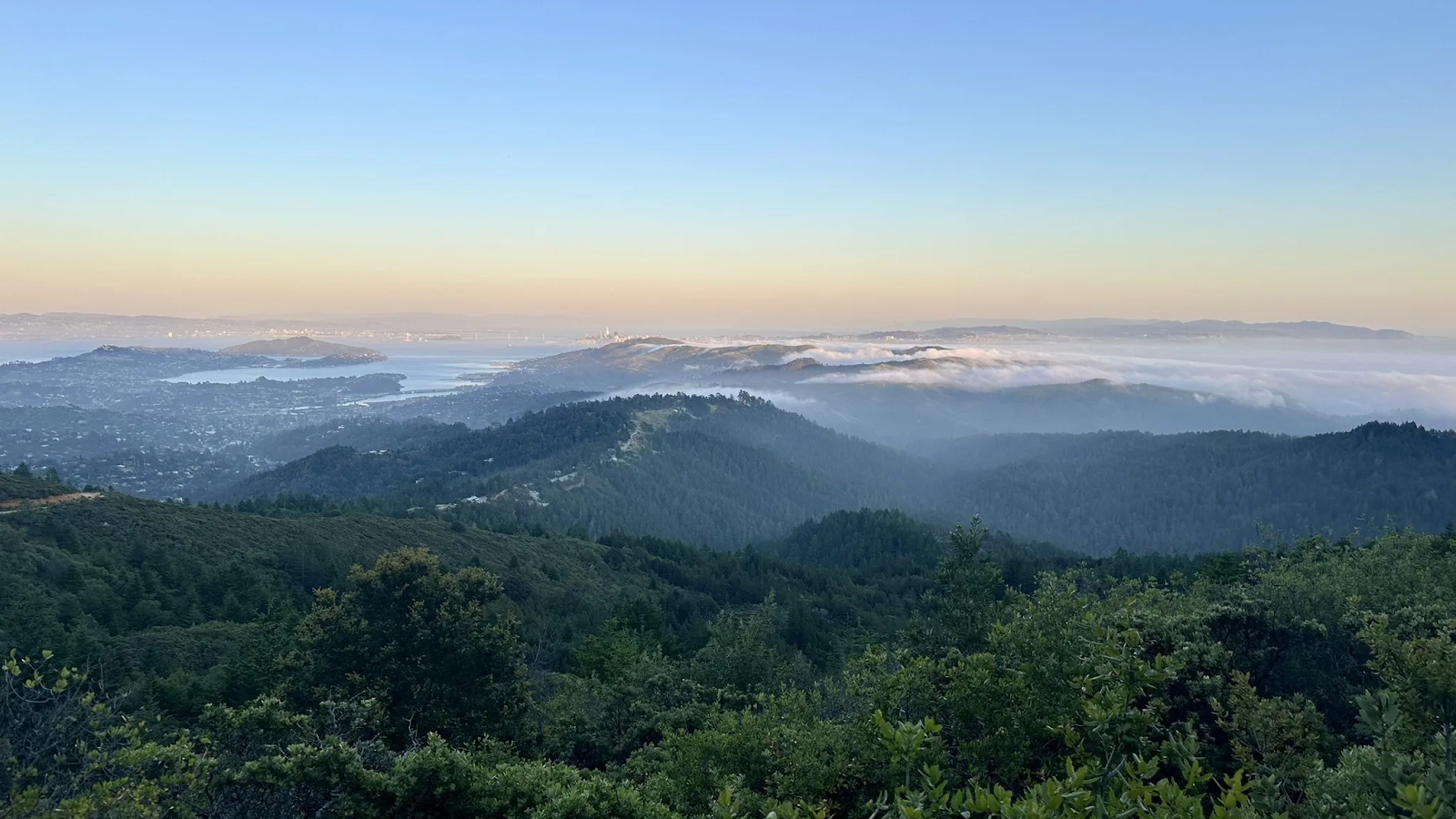
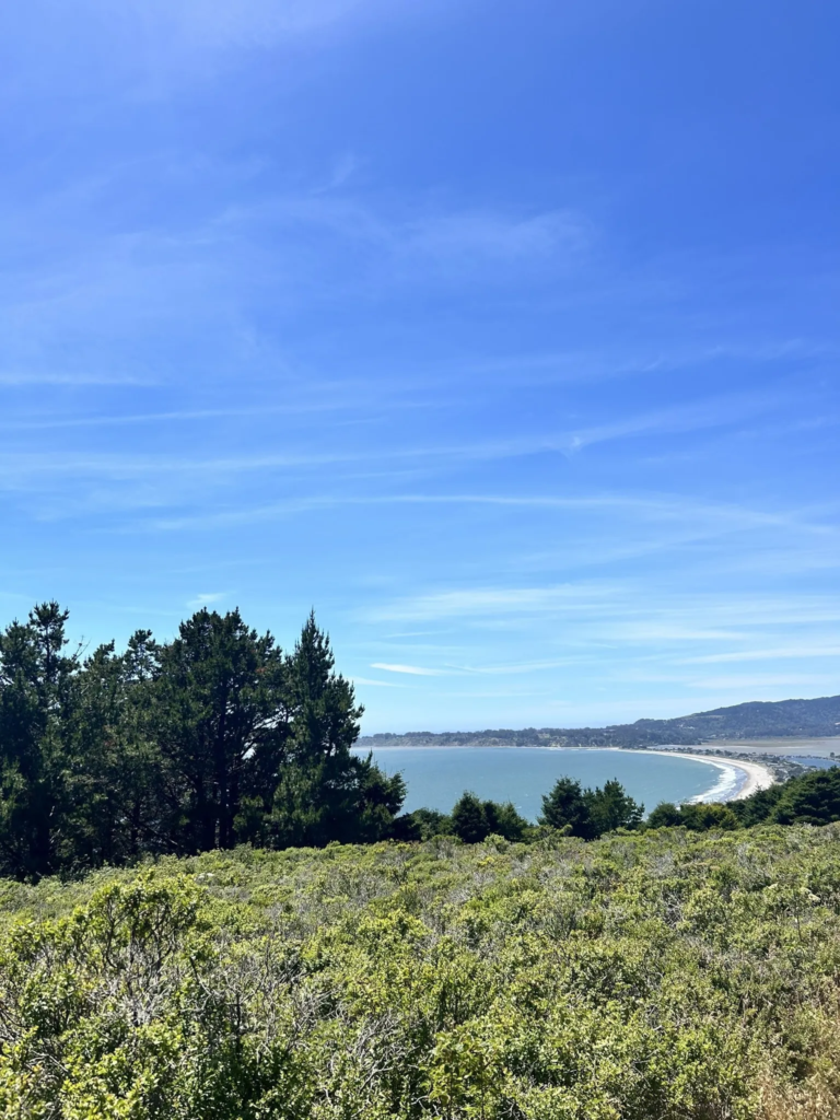
Nestled in Marin County, north of the Golden Gate Bridge, Mount Tamalpais (affectionately called “Mt. Tam” by locals) has a peak elevation of 2,571 feet. This majestic mountain offers stunning panoramic views of the San Francisco Bay Area, rolling hills, and on a clear day, even the distant silhouette of the Farallon Islands. Whether you want spectacular views of San Francisco or the Pacific Ocean, here it is.
Aside from hiking, there are several options for making the most of your time here. Overall Mount Tamalpais is an excellent destination for unwinding, whether it’s through admiring the views or having a staycation on elevated ground.
How to get to Mount Tamalpais
The distance from San Francisco to Mount Tamalpais State Park is approximately 13 miles. The easiest way to get there is by car. Take I-280 north across the iconic Golden Gate Bridge. From there, follow signs for Highway 1 North and then take the exit for Panoramic Highway (State Route 1). This scenic route will wind its way through rolling hills and redwood groves, eventually leading you to the heart of Mount Tamalpais State Park
Can You Drive Up Mount Tamalpais?
Yes, you can drive to the top of Mount Tamalpais! The Panoramic Highway provides a scenic route that takes you all the way to the East Peak parking area. From there, you can enjoy breathtaking views, visit the visitor center, or embark on short hikes to further explore the summit.
Park Fees and Costs
Though there is no main entrance fee to Mt Tamalpais. However, East Peak, Pantoll and Bootjack parking areas have parking fees. The current fee, as of June 2024, is $8 per vehicle. Muir Woods National Monument also has an entrance fee, which is currently $15 per adult.
What to bring
Here’s a checklist to ensure you have everything you need on this day trip to Mount Tamalpais.
- Footwear: Wear sturdy shoes or boots that provide good ankle support, especially if the trails are muddy or uneven. Waterproof boots can be helpful in wet conditions.
- Backpack: Choose a daypack with enough space to carry your essentials like water, snacks, and extra layers of clothing. Welcome to Micro Climates of the bay area!
- Hydration: Bring plenty of water, especially on hot days. A water reservoir can be a convenient way to carry and drink water while hiking. In general, bring at least 0.5 liters for every hour of hiking
- Navigation: Pack a map and compass in case you get lost. Downloading offline maps on your phone can also be a good backup.
- Food: Pack enough snacks to keep your energy levels up throughout your hike. Choose energizing options like nuts, granola bars, or dried fruit.
- Sun protection: Wear sunscreen and a hat to shield yourself from the sun’s rays.
- Clothing: Dress in layers so you can adjust to changing weather conditions. Opt for moisture-wicking base layers and a fleece sweater or jacket for warmth. A rain jacket can also double as a windbreaker.
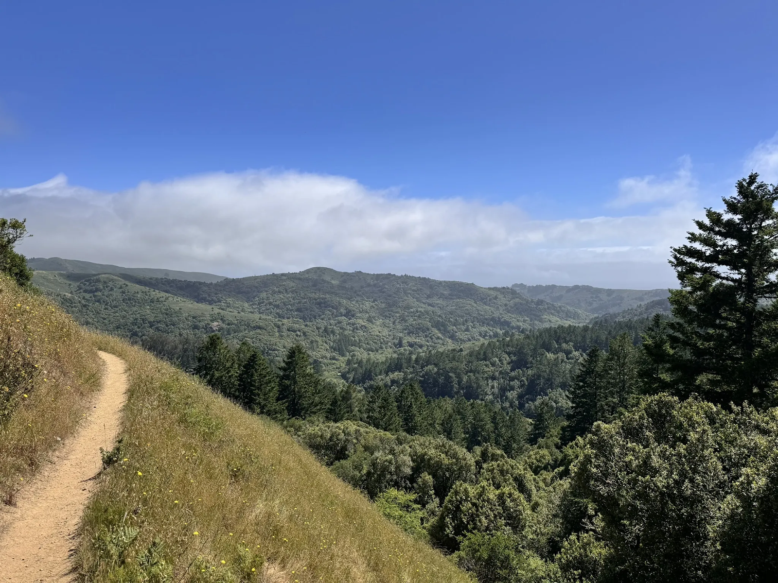
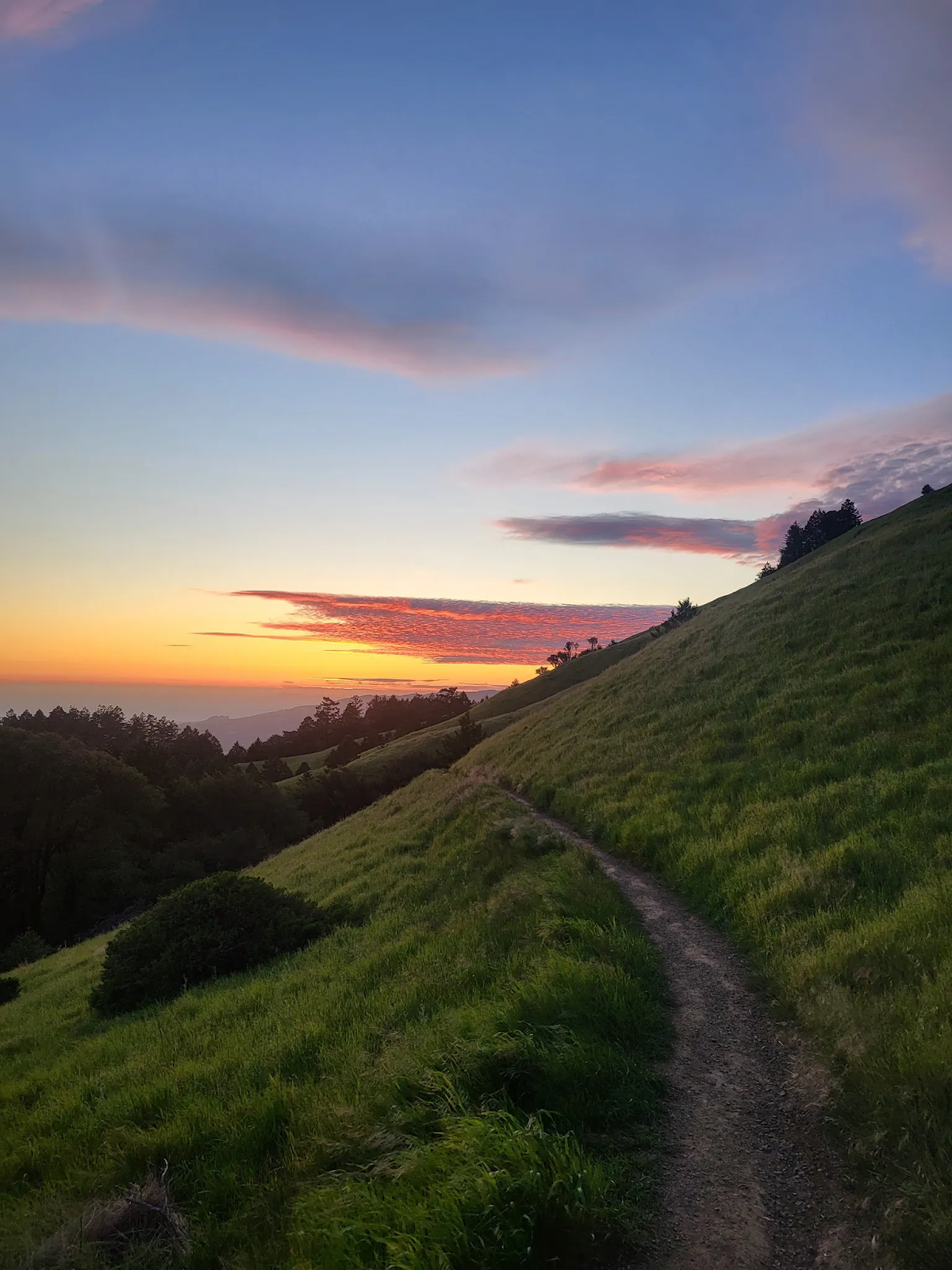
Best Hiking Trails at Mt. Tamalpais
Mount Tamalpais State Park is a hiker’s paradise, with trails catering to all skill levels. Here are a few popular options for your day trip to Mt. Tamalpais.
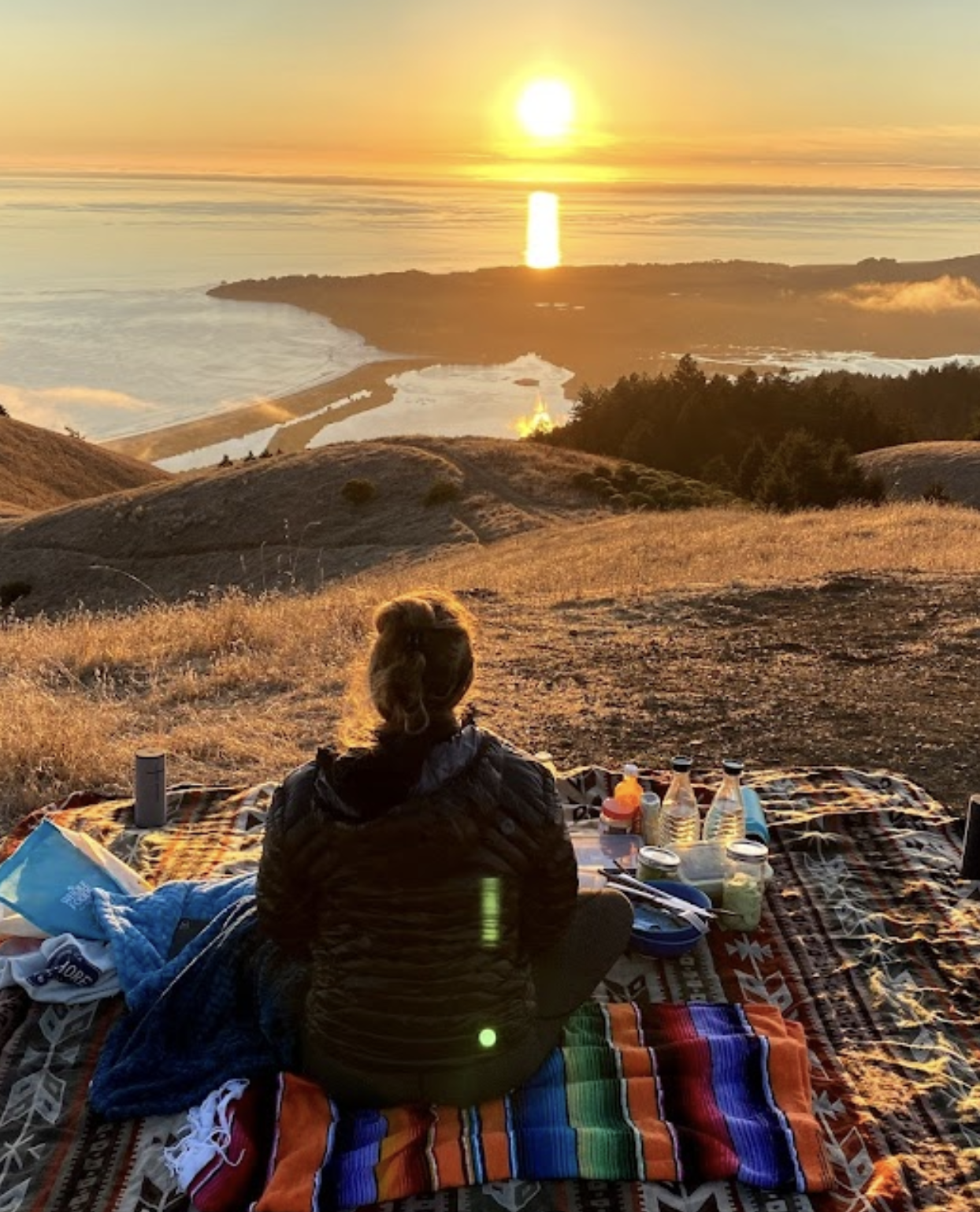
Just a PSA: Before you go on any of these hikes stop at the supermarket and get some cheeses, nachos, guacamole, grapes and cold drinks for a picnic on the top of the mountain. Thank me later.
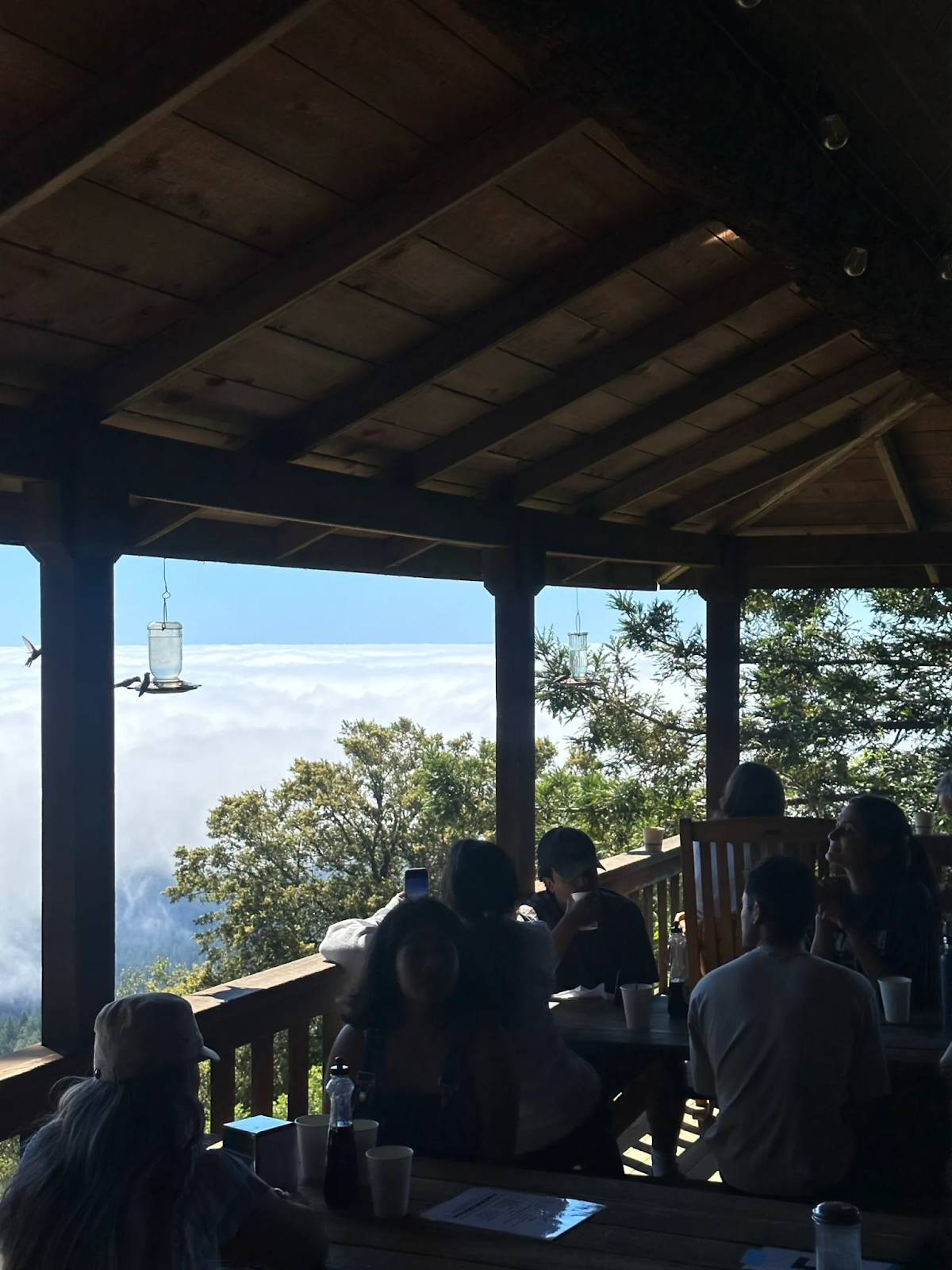
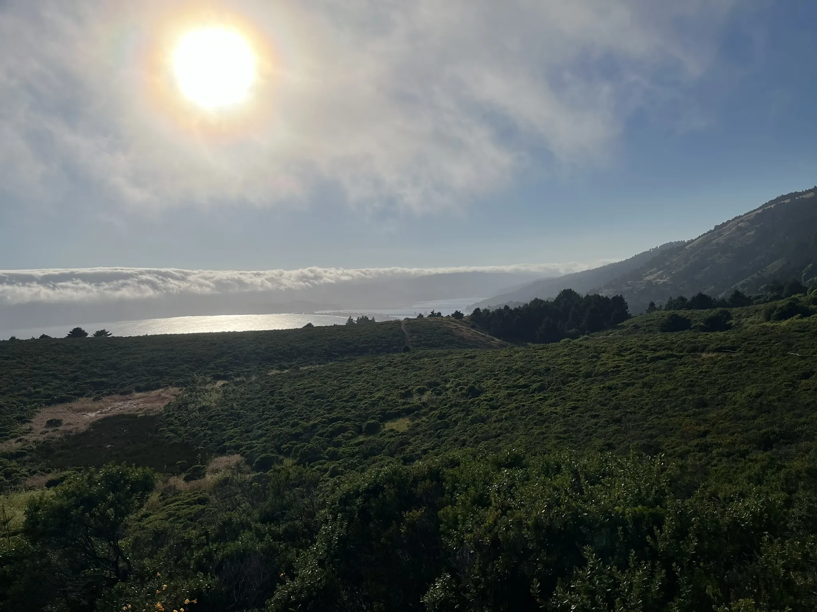
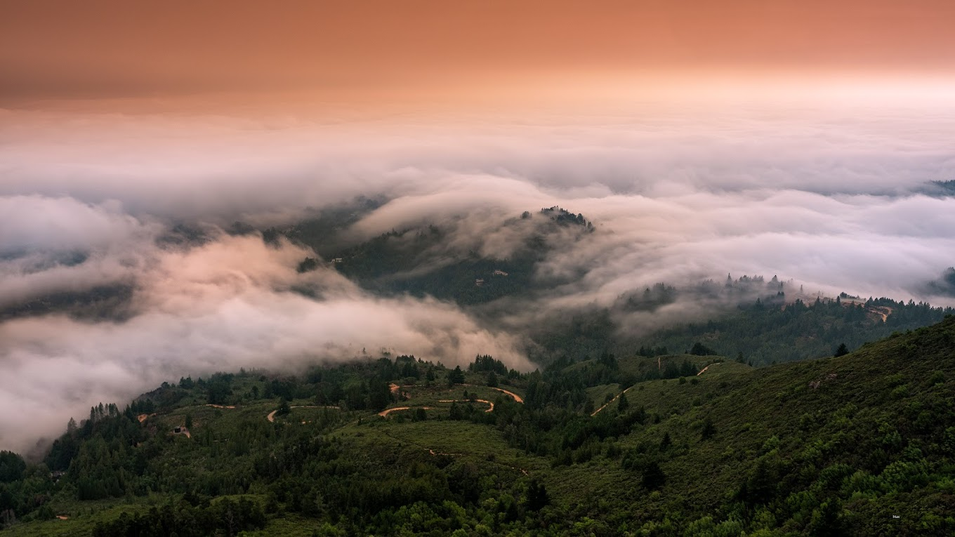
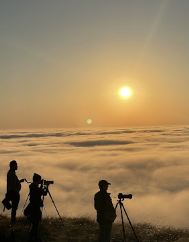
Oh, and the views of the city from Mount Tam on a super clear day are spectacular. OR if you catch the morning fog from up there you are quite literally above the clouds and it’s amazing.
Always check the fog forecast before leaving.
🥾THE PANCAKE TRAIL VIA ROCK SPRING TRAIL

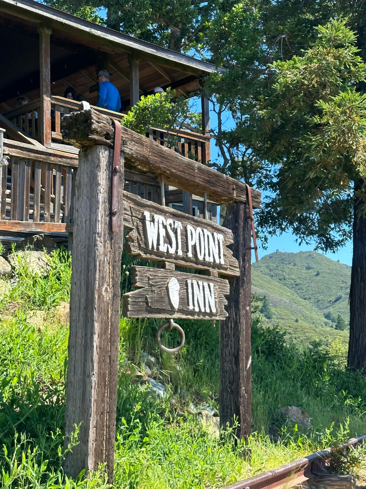
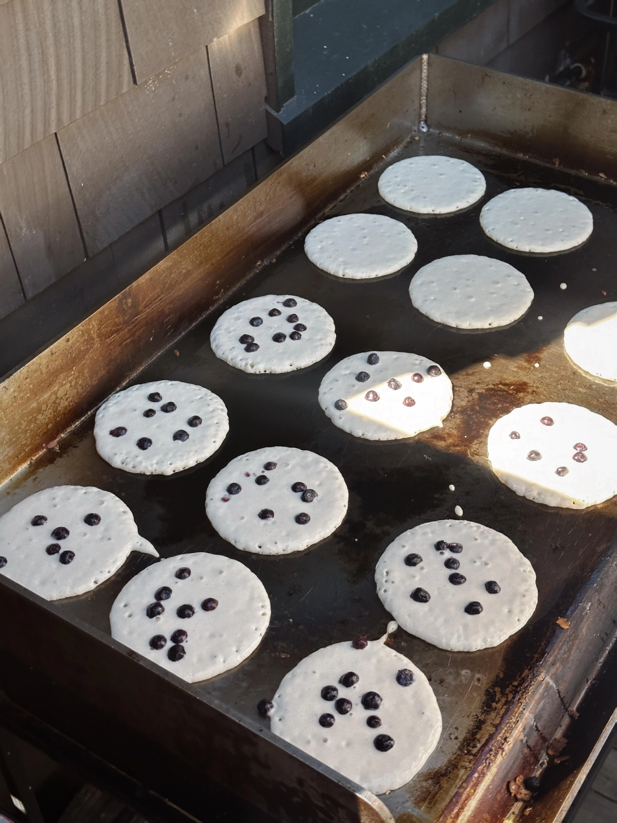

Mount Tamalpais gives you a chance to combine a hike with a delicious breakfast post hike on top of the mountain. Throughout the summer months (May to October), West Point Inn hosts special pancake breakfast events. This inn is only accessible by trail so you’ll have to hike to the historic inn and enjoy fluffy pancakes while soaking in the stunning scenery.
How To Get There
Numerous trails lead to West Point Inn where pancakes are served.
A detailed list of all routes can be found here.
Try doing the Rock Springs Trail which begins at the Mountain Play amphitheater and also parking is free! It’s level, scenic, offers a mix of sun and shade and there are several bathrooms/outhouses along the trail. You can also try parking at the Quarry Parking lot.
These events are popular, so arrive early! I had my first pancake breakfast at West Point Inn last summer. I remember getting there around 10:00 and waiting in line for about 40 minutes to order. Pancakes are served from 9:00 am to 1:00 pm and cost $13 for adults and $8 for children under 12. They even offer blueberries in season for an extra treat. Cash, check, or Venmo are accepted for payment. Oh and they have coffee for an extra dollar!
Related Reads: The Bay Area’s Most Relaxing Beach Getaway to Angel Island State Park
Mark your calendar for these 2024 dates if you’re interested: May 12th, June 16th, July 14th, August 11th, September 8th, and October 13th. NO reservations are needed . A schedule of upcoming pancake breakfasts can be found here.
🥾DIPSEA STEEP RAVINE MATT DAVIS LOOP


The most popular and most highly rated hike on Mt Tamalpais in the 7 mile range is the Dipsea – Steep Ravine – Matt Davis Loop, from Stinson Beach.
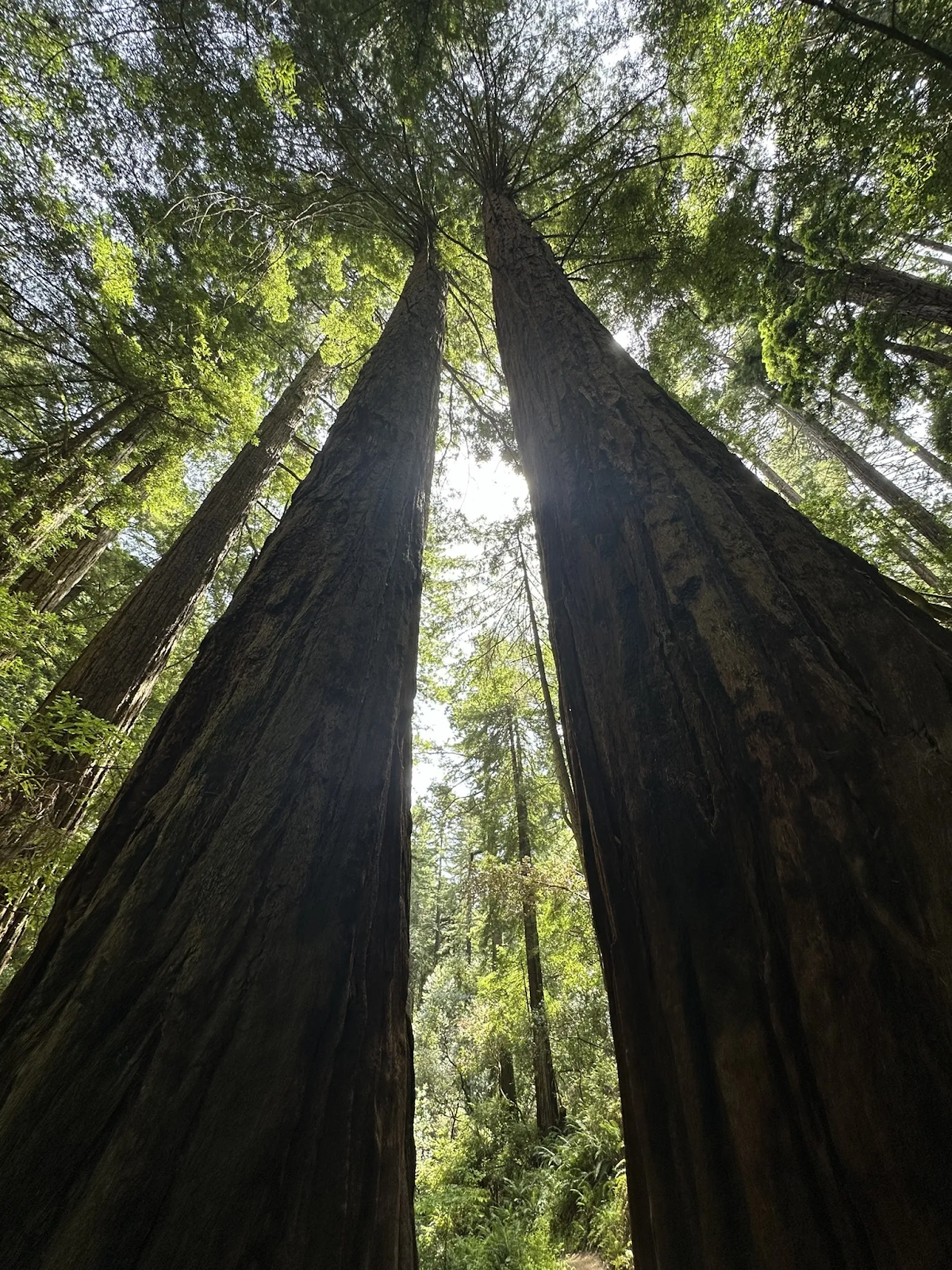
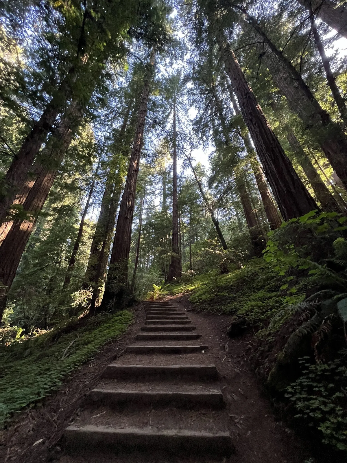
For experienced hikers, the 7-mile Dipsea-Steep Ravine-Matt Davis loop offers a challenging adventure. This route winds along ocean cliffs, climbs through redwoods with waterfalls, and traverses meadows with bay views. It’s the perfect mix between seeing coast and redwoods.
Allow 4-6 hours and be prepared with plenty of water, snacks, and sturdy footwear for uneven terrain. This rewarding hike showcases the diverse beauty of Mount Tamalpais State Park.
🥾CANOPY DIPSEA AND SUN TRAIL LOOP
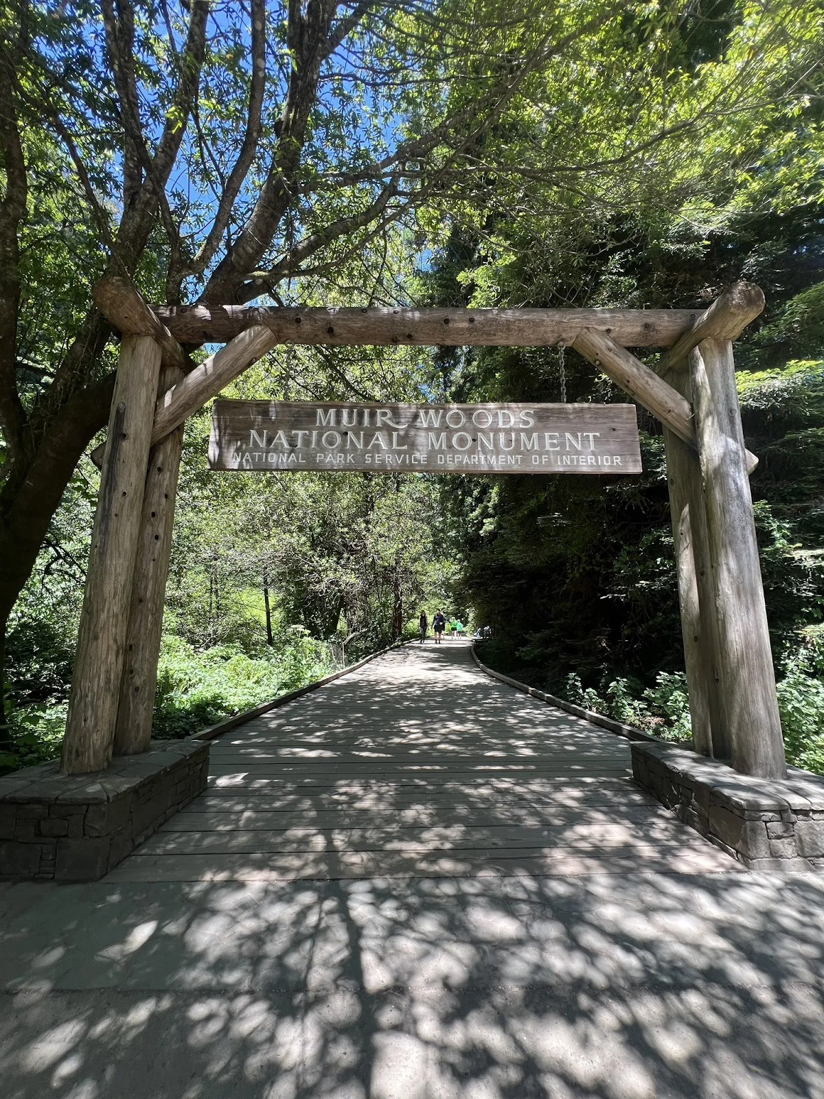
This 4.8 mile trail is also another one of my favorites because you get to see Muir Woods AND Mt. Tam. It is always a hit when I have people visiting.
If you start at Mountain Home Inn (the entrance point of the trail is across the street) and hike down into Muir Woods and then loop back up – you get to do both! Parking has been pretty easy, I’ve only ever gone on the weekend and have never had trouble – even if the lot is full, lots of people park on designated turnouts along the side of the road.
Related Reads: Top Ten Travel Hacks you Never Knew You Needed in 2024
🥾MOUNT TAMALPAIS WEST PEAK LOOP
The West Peak Loop is 6.2 miles and rated moderated. This loop trail offers breathtaking panoramic views of the bay and the city skyline. Be prepared for some incline, but the reward at the top is worth the effort.
Other things to do at Mt. Tamalpais
For those who prefer a less strenuous adventure, Mount Tamalpais offers other ways to explore its beauty.
Check out the Gardner Fire Lookout

No Mount Tam escape is complete without the Gardner Fire Lookout. Perched on the East Peak, this historic tower offers breathtaking panoramas of the entire bay area. Built in the 1930s, it’s still an active fire lookout during fire season.
To get there, head to the East Peak parking area. A short, mostly paved trail leads up. Take in the views of the city, Golden Gate Bridge, and rolling hills.
Informative plaques share the history of fire lookouts. It’s a manageable walk with a big reward! It’s the perfect sunset opportunity!
Visit the Mount Tamalpais State Park Visitor Center
Located at the East Peak, the visitor center provides exhibits about the park’s ecology, history, and stunning panoramic views.
Take a Panoramic Highway Drive up to the mountain
Take a leisurely drive along the Panoramic Highway, which winds its way through the park, offering breathtaking vistas at every turn. Its a very windy, but many point to stop and rest.
In case you didnt know…
- There are trails that begin from Panoramic Highway down into Muir Woods so you don’t have to reserve parking or pay an entrance fee. Bootjack and Mountain Home Inn are two places to park. Be warned though, on weekends they fill up early.
Related Reads: Paddle Through a Fairytale at Blue Heron Lake in the middle of San Francisco
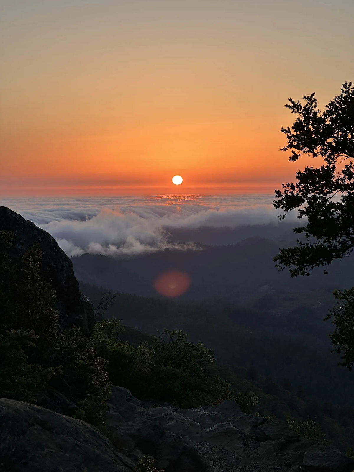
Watch a Sunset above the clouds

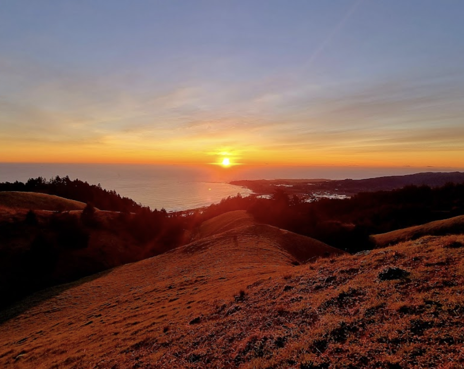


Mount Tamalpais is renowned for its captivating sunsets. For the best viewing experience, head to West Peak shortly before sunset. As the sun dips below the horizon, the sky explodes in a kaleidoscope of colors, painting the clouds and the bay in a mesmerizing fiery display.
Guys… I am telling you my secret spots to watch the sunset on Mt. Tam. Most will be on Ridgecrest Blvd, so maybe it’s not so secret anymore.. But here they are in no particular order.
Best Places to see the Sunset in Mt. Tamalpais
- 🌄The Nip Parking
- 🌄Laure Dell Trailhead
- 🌄Parking for 8 cars
- 🌄 O’Rourke’s Bench
- 🌄Trojan Point
- 🌄Ballou Point
- 🌄Forbes Bench
Where to stay at Mt. Tamalpais
If you’re looking to extend your escape and turn your day trip into an overnight adventure, several charming options await.
Steep Ravine’s Historic Cabins

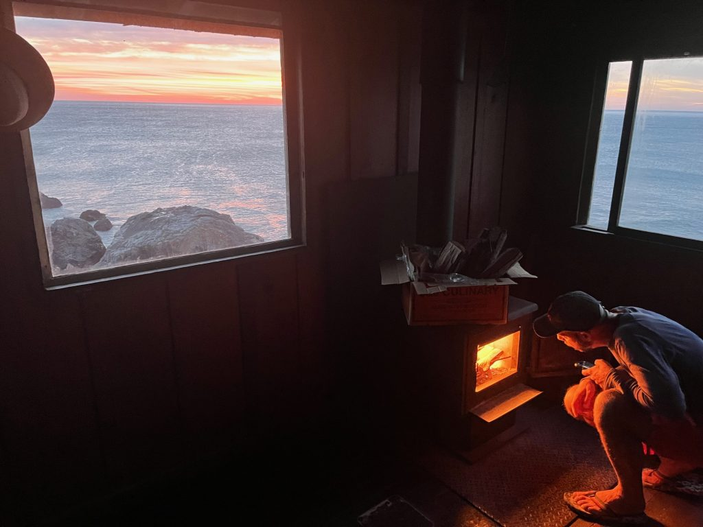
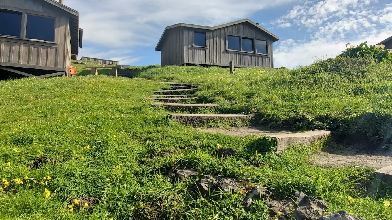

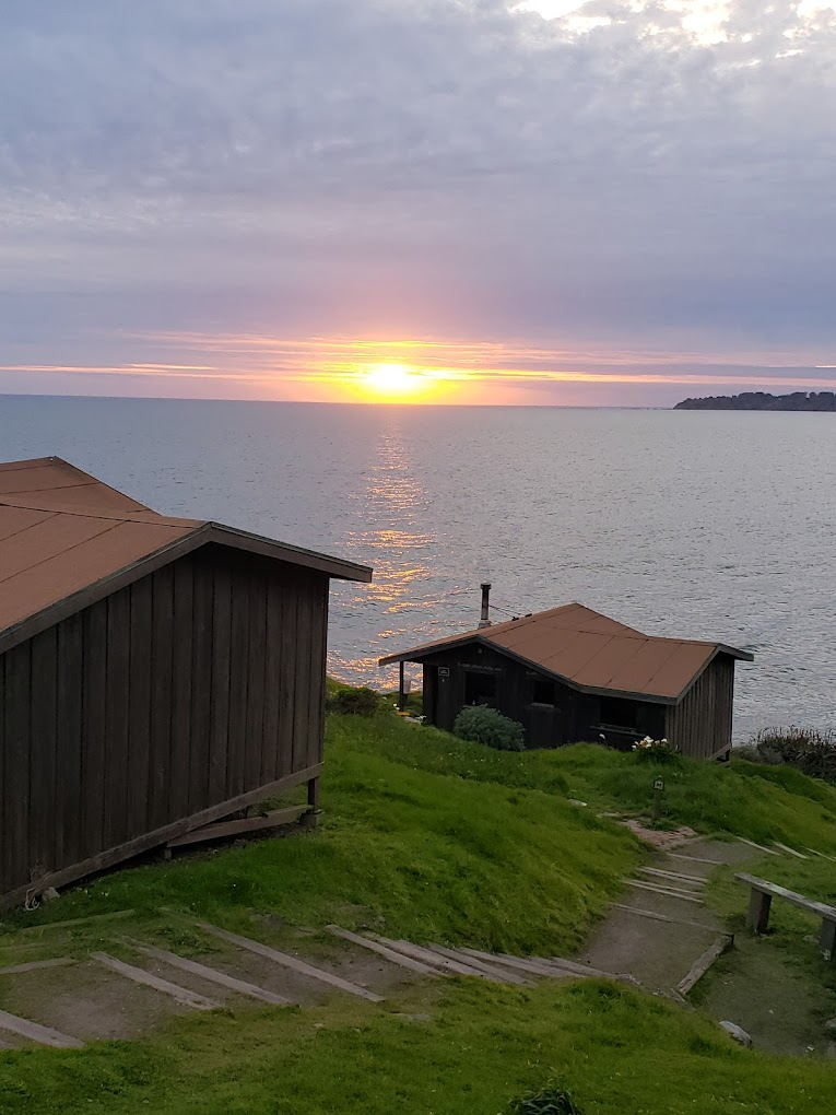
Nestled amongst the redwoods, these rustic cabins offer a unique and intimate connection with nature. They are in the perfect location right on the edge of the cliff, well not literally but close enough to see the water .
Keep in mind they are just cabins. The interior is bare bones, bring all you need to sleep. Mattress, blankets, pillows, etc. But it’s the best place to watch the sun rise and set, and to fall asleep under the stars to the sound of the waves. Bring anything you would bring from camping minus the tent. Reserve early!
Mill Valley Inn

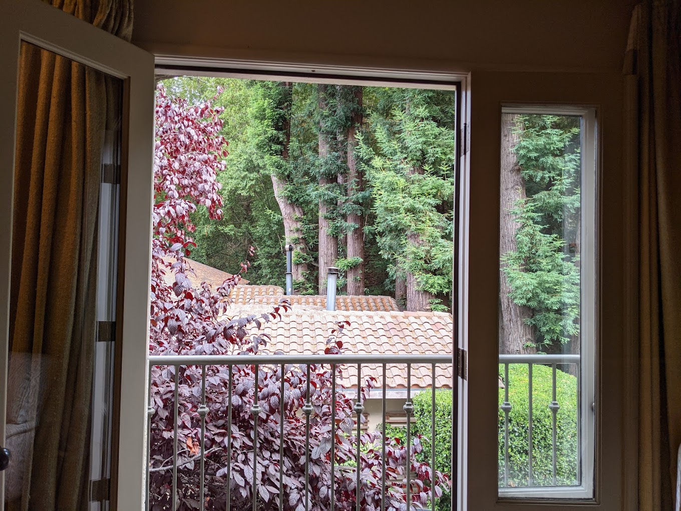
This charming inn located in the nearby town of Mill Valley provides comfortable accommodations and a touch of historic charm.
Mountain Home Inn
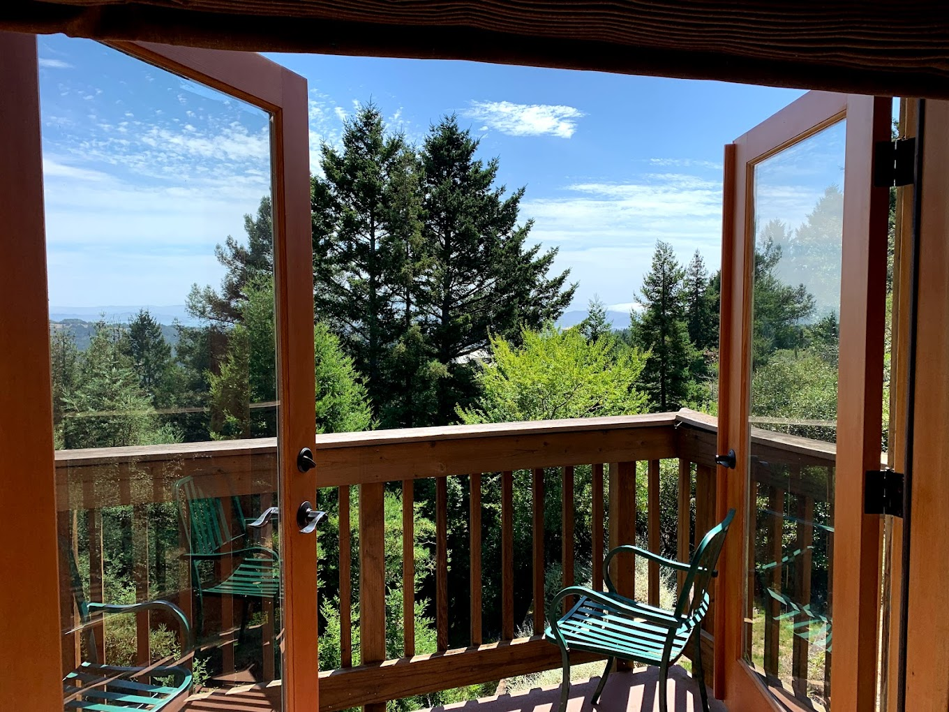
Situated at the foot of Mount Tamalpais, this inn offers a peaceful escape with stunning mountain views
Related Reads: Stay in Tiny Cottages on This Idyllic Northern California Coast Beach Resort
A Sample Itinerary for your day trip to Mt. Tamalpais
In the Morning:
- Start your day with an early breakfast in San Francisco. Consider grabbing pastries or a breakfast burrito to take with you on the drive
- Hit the road around 8:00 am to avoid traffic and ensure enough time for your planned activities. Enjoy the scenic drive across the Golden Gate Bridge and along the Panoramic Highway.
- Arrive at Mount Tamalpais State Park around 9:00 am. Choose your adventure!
- Option 1: Drive to the East Peak parking area and visit the visitor center for panoramic views and exhibits about the park’s history and ecology.
- Option 2: Embark on a more challenging hike like the Old Mill Trail (4.8 miles) or the Mount Tamalpais West Peak Loop (4.2 miles). Enjoy a picnic lunch with breathtaking views at the summit.
In the Afternoon:
- After your morning activity, head to the charming town of Mill Valley for lunch. This vibrant town offers a variety of restaurants and cafes to suit your taste buds. My go-to is always Sol Food in Mill Valley. Getting a cuban sandwich and eating in the parking lot after a long hike is perfect every time. Or grab sandwiches at Inverness Park Market
- In the afternoon, consider these options:
- Explore Muir Woods National Monument (entrance fee applies). Be awestruck by the towering redwoods and immerse yourself in the beauty of this ancient forest.
- Relax and soak up the views at the West Point Inn. Enjoy a refreshing beverage or a delicious meal with a stunning mountain backdrop.
- Take a leisurely drive along the Panoramic Highway, stopping at scenic viewpoints to capture the beauty of the landscape.
In the Evening:
- As the day winds down, head back to Mount Tamalpais for a spectacular sunset picnic. The East Peak or West Peak offer prime viewing locations for a breathtaking display of colors.